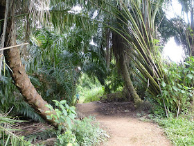
Our hike would start from Bukit Panjang Food Centre to the Chestnut Nature Park via the Nature Trail and back to the starting point via Zhenghua Park a distance of about 8.5km.
Chestnut Nature Park consists of two areas the Chestnut Nature Park North and Chestnut Nature Park South separated by Chestnut Avenue. Each area has its own dual sets of separate hiking and biking trails. The hiking trails have total distance of 5.6km and the biking trails 8.2km.
 |
| Chestnut Point |
The Route
We walked along Bukit Panjang Road turned left along Bangkit Road and right into the carpark at Block 271. We passed the Pipeline Trail toward Zhenghua Park. There is a track that leads under the Bukit Timah Expressway. After that we took the right trail leading uphill to the Northern Trail.
We walked along this past the Bangkit Shelter and moved in an easterly direction until Piper Hut where we turned south. The previous Chestnut Track had been reshaped into a bike and walking trails.
 |
| Nature Trail |
Eventually we reached Chestnut Ave where we turned right toward the Visitor's Centre now named Chestnut Point just a short distance away. Here there are toilet facilities where we could also refill our water bottles. There is a bike rental shop here as well as vending machines. Cyclists can also wash their bikes after their rides.
Chestnut Nature Park North
We took the Nature trail that was newly opened in February. This trail lies besides the Bukit Panjang Exit of the Bukit Timah Expresswway. There were a couple of new bridges spanning the streams. There is also a fallen log where we could walk on it as part of the walking trail. One should check the map board to ensure he is going in the right direction or end up in an endless loop. On the day of our walk we came across a number of hikers here to check out the trail one week after its official opening. After finishing the Northern Nature walking trail we returned to Chestnut Point.
 |
| Northern Nature Trail |
Chestnut Nature Park South
After a short rest we proceeded to the southern section to enjoy the walking trail there. This trail is 2km long. It was opened in 2016.
 |
| Southern Nature Trail |
The first half of the trail runs roughly parallel to the BKE then turn back in a northerly direction back to Chestnut Ave. There are two rest huts along this trail. When we returned to Chestnut Ave we walked along it until Zhenghua Park where we turned right to walk toward Bukit Panjang where we ended our walk.
Mapboard at Chestnut Point
Related Posts
Pipeline Trail from Bukit Panjang to Woodlands
The Pipeline Trail
GPS Track
 |
| Map data ©2017 Google, Urban Redevelopment Authority |

No comments:
Post a Comment