Pages

October 4, 2017

Hong Kong Dragon's Back and The Peak Trail

 
Dragon's Back Trail

Dragon's Back
 
Numerous sources indicated that we have not seen Hong Kong unless we trekked Dragon's Back. So here we were on our way to the eastern part of Hong Kong Island. Dragon's Back is the last stage or stage 10 of the Hong Kong Trail spanning the whole island, a total distance of 50km.


Shek O Peak

We followed directions on how to get there by taking the train to Shek Kei Wan and leaving the station at exit A3. Then followed the signs to catch bus #9. The bus was full with both local and foreign trekkers. We alighted at To Tei Wan. Each bus has a next bus stop indicator so it was easy to know where to get down. In our case most of the hikers got down at the same stop so it was no issue. There was a map-board at the beginning of the trail beside the Tai O Road. There were two portable toilets here but the condition at that moment was indescribable.

Shek O Village

It was uphill all the way until we arrived at Shek O Peak the highest part at 284m.
The view at Shek O Peak was spectacular. The weather was perfect and the combination of blue sea, blue sky, island, background hills and white clouds made the views picture perfect. From there you can see Shek O Village and Big Wave Bay our destination. Hordes of students and groups of locals congregated here resting on the benches, taking pictures with the height marker and drinking in the view.


The first part of the trail was exposed and relentlessly uphill but the subsequent part was shaded by the natural shade provided by the trees. We had to be more cautious on the final descend to Big Wave Bay as the steps were built of natural stone elements. We had a simple lunch when we finally arrived at Big Wave Bay. We then took a minibus back to

Shek Kei Wan.

The Peak

As it was still early in the day we all agreed to trek the Peak. We took the train to Central to catch bus #15 at Exchange Square to the Peak.

Hong Kong Harbour from Peak Trail

We arrived at the Peak Tower just in time to catch the sunset. After taking some pictures we proceeded to Lugard Road to walk the trail around Victoria Peak. At the northern part of the trail we had a spectacular view of Hong Kong harbour as the sky turned dark in the early evening. The skyscrapers were lighted up giving a postcard view of Kowloon. At the western part of the trail Lugard Road merged into Harlech Road that led us back to the Peak Tower where we queued to take the train back to Central. This trail would have given us views of the northern and southern part of Hong Kong Island but by the time we started the trail it was already evening and we caught only the views from the northern part of the trail. If we had another opportunity we should do a day trek of the trail combined with trekking the 1st stage of the Hong Kong Trail.

The Peak Trail

Map data ©2017 Google

June 12, 2017

Chestnut Nature Park

Chestnut Nature Park
Our hike would start from Bukit Panjang Food Centre to the Chestnut Nature Park via the Nature Trail and back to the starting point via Zhenghua Park a distance of about 8.5km.
Chestnut Nature Park consists of two areas the Chestnut Nature Park North and Chestnut Nature Park South separated by Chestnut Avenue. Each area has its own dual sets of separate hiking and biking trails. The hiking trails have total distance of 5.6km and the biking trails 8.2km.


Chestnut Point

The Route
We walked along Bukit Panjang Road turned left along Bangkit Road and right into the carpark at Block 271. We passed the Pipeline Trail toward Zhenghua Park. There is a track that leads under the Bukit Timah Expressway. After that we took the right trail leading uphill to the Northern Trail.


We walked along this past the Bangkit Shelter and moved in an easterly direction until Piper Hut where we turned south. The previous Chestnut Track had been reshaped into a bike and walking trails.


Nature Trail

Eventually we reached Chestnut Ave where we turned right toward the Visitor's Centre now named Chestnut Point just a short distance away. Here there are toilet facilities where we could also refill our water bottles. There is a bike rental shop here as well as vending machines. Cyclists can also wash their bikes after their rides.

Chestnut Nature Park North
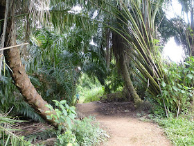
We took the Nature trail that was newly opened in February. This trail lies besides the Bukit Panjang Exit of the Bukit Timah Expresswway. There were a couple of new bridges spanning the streams. There is also a fallen log where we could walk on it as part of the walking trail. One should check the map board to ensure he is going in the right direction or end up in an endless loop. On the day of our walk we came across a number of hikers here to check out the trail one week after its official opening. After finishing the Northern Nature walking trail we returned to Chestnut Point.


Northern Nature Trail

Chestnut Nature Park South
After a short rest we proceeded to the southern section to enjoy the walking trail there. This trail is 2km long. It was opened in 2016.


Southern Nature Trail

The first half of the trail runs roughly parallel to the BKE then turn back in a northerly direction back to Chestnut Ave. There are two rest huts along this trail. When we returned to Chestnut Ave we walked along it until Zhenghua Park where we turned right to walk toward Bukit Panjang where we ended our walk.

Mapboard at Chestnut Point


Related Posts
Pipeline Trail from Bukit Panjang to Woodlands
The Pipeline Trail 

GPS Track

Map data ©2017 Google, Urban Redevelopment Authority

March 25, 2017

Pipeline Trail from Bukit Panjang to Woodlands

Pipeline Trail
For this walk we revisited part of the Pipeline Trail that runs from the Causeway to Rifle Range Road parallel to the Bukit Timah Expressway BKE.

Central Catchment Park Connector
As usual we started from the end of Bukit Panjang Road by way of Zenghua Park and following a trail that led under the BKE. Just after the BKE, we took the trail that veered to the left and turned northward. This is the Gangsa Track used by both hikers and bikers to get to the Central Catchment Park Connector.


Bamboo grove on the Central Catchment Park Connector
Along the way we skirted the occasional puddles left by the recent thunderstorms. One of our hikers had a field day adding more photos of butterflies to his collection. Some of these were rare according to him. We enjoyed calling for his attention whenever we sighted any along the way. At times we also helped to take some photos if he was not nearby or to avoid disturbing the butterflies with our excessive movement. Once I had to keep still as three different species chose to dance around next to my feet. My friend managed to capture them on video dancing for us.

It was a hot day and we encountered only 2 hikers and 2 bikers. We saw the 2 bikers again after they reached their destination and turned around for the return trip. These were local bikers and we exchanged friendly greetings and words of encouragement.

When we arrived at Mandai Road, we had a brief water stop near the Shimano repair station. Then we turned left to walk past the army camp to the traffic light to cross to the northern part of the road. When we arrived at the trail we turned left to climb up the slope.


At Seletar Expressway
The Pipeline Trail
From here to Woodlands St 41, we would come across 3 sets of exposed pipes. On the first one, near Lorong Asrama, and the third one, near the American School, we had to cross over on one of the pipes. For the second set, under the Seletar Expressway, we could skirt around them. Just after crossing the first set of pipes, we could see durian trees in the forest on our right. We could see the remnants of the fruits from the past season. Some pickers must have enjoyed a feast months ago. We did not see any flowers or fruits on the trees as the durian season was over.

Exposed pipelines along the trail
The trail near the American School was usually muddy but because the day was hot, the trail was relatively dry except where we exit near St 41. When we encountered these soft patches, we quickly turned toward higher ground which was better drained.

By the time we reached Woodlands St 41, we were hot and thirsty. The coffee-shop at Ave 1 was a welcome sight. The first thing we had was 100Plus to replenish the salts lost during our walk. Distance walked was about 9km.


The Route
Map data ©2017 Google, Urban Redevelopment Authority

Related Posts
The Pipeline Trail