Showing posts with label singapore. Show all posts

November 25, 2011

Woodlands Town to Bukit Panjang via Ulu Sembawang Park Connector

The Route
This route came about to satisfy two criteria viz. to walk along park connectors with their well paved tracks and secondly along forests for their shade, greenery and away from traffic. We achieved this by starting from Woodlands (Causeway Point) after a hearty lunch and proceeding southward along the Woodlands Park Connector (Ave 2) to the Ulu Sembawang Park Connector (PCN) to the Mandai PCN. Then we travelled along Track 15 (Central Catchment PCN) in Mandai to the Gangsa Bike Trail to Bukit Panjang. See the GPS track below.
Open field at Woodlands Park Connector

Woodlands Park Connector
Walking along the Park Connector from Woodlands to Ulu Sembawang was uneventful except for the hot weather as we started walking at about 12 noon. After walking southward along Ave 2, we passed the Singapore Sports School where our elite athletes train and have their education. The path eastward from the school was blissful and reminded us of the Von Trapp children singing in the Austrian Alps as the track bordered a huge expanse of wide open field on high ground making us feeling liberated. On a previous trip one of our fellow walkers found a lost kite and ran with it and I sang "the hills are filled with the sound of music, etc." Unfortunately he suffered a minor injury as a result but is okay now. Before embarking on this stretch, one got to be careful of thunderstorms as it is exposed.

Ulu Sembawang Park Connector
Near the junction of Ave 12 and the SLE we headed southward along the Ulu Sembawang PCN. This track took us through the forests of Mandai used by Mindef for training their troops. On the west was the Mandai forest with the forbidding "Protected Area" sign and on the east were the farms. The track was just opened several months ago - kudos to the Nparks for building it and allowing us access through the Mandai forest. At the end was Mandai Road and the Seletar Reservoir. We turned west towards the Singapore Zoo direction. We could see the outline of durian trees as we walked, but no fruits as it was out of season.

Central Catchment Park Connector
At the Mandai Lake Road which led to the Zoo, we followed a track called the Central Catchment PCN. This narrow track is within the forest of Mandai and is left unpaved as close to its natural condition. There were occasional fallen trees due to heavy rain and wind but we were able to continue our trek. This trail roughly parallel Track 15  leading to the Mandai Rifle Range. On certain days we could hear the sound of gunfire. As we proceeded along, we could spot the silhouette of durian trees. This was dutifully recorded as a POI on our GPS track for a visit when the fruit is in season. The Central Reserve PCN had been realigned to join up with the Gangsa Bike Trail to which we emerged when we came to the end of the park connector.
Gangsa Bike Trail

Gangsa Bike Trail
We did a side trip to the PUB pumping station to clock up the mileage we wanted to achieve. The bike trail was easy going although we were accompanied by mosquitos but thanks to our buddies for whom they had more affection, the rest of us were spared the ordeal. Towards the end of our trek we arrived at the abandoned garden beside the BKE under which we walked toward Bukit Panjang Kim San Leng coffee-shop for a short rest before heading home.
GPS Track

Map data ©2020 Google, Urban Redevelopment Authority

October 1, 2011

Kallang Park Connector

Fishing at Lower Peirce Reservoir Park
Bishan Park
For this walk, we chose to start from the direction of Bishan Park and end at Kallang. Before starting on the park connector, we paid a visit to the Lower Peirce Reservoir Park which was nearby. In this park there is a small area set aside for fishing. The Lower Peirce Reservoir is the start of the Kallang River. The river used to be a concrete lined canal all the way to the Kallang Basin. However the canal in Bishan Park is being converted into a riverine type environment with plants growing along the banks giving the river a softer more natural look. Part of this was completed as seen in the accompanying photos. McDonald's has an outlet in the park near one of the futuristic looking bridge with its gentle curves. The outlet is clean, modern and fairly large but surprisingly with a small toilet facility. This will cause congestion during weekends with many families from Bishan and Ang Mo Kio visiting with their families and baby strollers. Bishan Park stretches almost 3km from west to east with landscaped lakes, river banks and a driving range nearby. It is bordered to the north by Ang Mo Kio and on the south by Bishan.

Bishan Park
Kallang Park Connector
The Kallang Park Connector runs along the Kallang River connecting Bishan Park to the Kallang Park. The distance is about 10km from Upper Thomson Road to Kallang Station. The walk is easy and basically on level ground. It is well marked and maps strategically placed. Easy to find your way along the route but tricky near Kallang as there are several canals joining up. The river within Bishan Park is well landscaped and attractive. One can spend some time here admiring the scenery and the bridges once the park is fully redeveloped and open.

St Andrew's Bridge
Across from the eastern edge of Bishan Park is the Bishan depot of the SMRT where recently there was a break-in and a train got a free paint job on its side panels. The traditional top-down approach was evident. As we walked along the park connector we could see some photographers checking out the fences. We did not know that they were reporters from the local media until the next day when an article analyzed how the break-in was supposed to have occurred.

We crossed Braddel Road using the overhead bridge. At the Central Expressway, the Kallang Park Connector went under it. It is well lit and lined with shrubs and flowering plants along the way. It allows both cyclists and hikers to use it.

Kolam Ayer Waterfront
After Potong Pasir Avenue, we walked under a sheltered bridge that spanned the Kallang River connecting St. Andrew's Jr College to St. Andrew's Junior School. This is the only school with its own private bridge across a river.

We crossed the PIE via an overhead bridge to Moonstone Lane. At the Kolam Ayer Waterfront, there is a floating platform along which visitors can walk for a better sense of the Kallang River. There are also devices to illustrate different types of water pumping equipment used in the past such as the Archimedes screw. The newly completed 'The River Vista@Kallang' is situated right in the middle of this richly landscaped area. The bridges across the river here were designed to complement the environment with their aesthetic and modern curves.

Related Articles
Bishan Park - Kallang Park Connector
Gardens by the Bay East | Marina Barrage
Kallang Basin and Marina Reservoir Walk


The Route

Map data ©2020 Google URA
 

September 21, 2011

Lim Chu Kang Farms

The Route (see map below)

The objective of this route was to visit the Lim Chu Kang Agrotechnology Park, Turut Road (BBC transmitters) or Neo Tiew Lane 2 marshland.
  • Take Bus 975 from Chua Chu Kang Station.
  • Alight at Lim Chu Kang (LCK) jetty.
  • Walk along LCK Lanes 8, 6, 3 to Neo Tiew Road
  • Turut Road or Neo Tiew Lane 2
  • Neo Tiew Road to LCK Road. Take 975 back to Chua Chu Kang Station

Lim Chu Kang Jetty

The Lim Chu Kang jetty is used by fish farmers to send off their harvest to the local restaurants. There is a marine police post here to ensure users are genuine and not illegal immigrants. The post has several boats to patrol the area.


Lim Chu Kang Agro-technology Park

The Lim Chu Kang Agro-technology Park is bound by Lim Chu Kang Road and Neo Tiew Road. It was developed for companies involved in production of livestock, aquarium and food fish, vegetables, fruits, flowers and other plants, as well as for the breeding of dogs. To the east is the Sungei Buloh Wetland Reserve.

Meninjau trees

Lane 8 and 6C
. The roads are lined with the Meninjau trees (gnetum gnemom) that are cultivated in kampongs throughout Southeast Asia for their edible leafy shoots and ‘fruit.’ The latter can be made into a sort of flour used to prepare the fried crackers known as keropok or embing. This is a most popular snack in Indonesia and frequently found with every meal.


At the end of Lane 8, we turned left on lane 6C leading to Lane 9 to explore all the way to the coast. Along this road are fish farms breeding dragon fish.


Cashin's house

At the end of Lane 9, we noticed a track on the left. After going past the vehicle barrier, we followed this track that eventually led to an abandoned house built on a pier jutting into the Johor Straits. It used to belong to lawyer Cashin. We could see numerous fish-farms and the Johor coastline across the Johor Straits from here.

Returning to Lane 9, we continued on Lane 6C, 6, 5, 5A and 3 to arrive at Neo Tiew Road. Lanes 3 and 5 are popular access roads for traffic from Kranji side of Neo Tiew Road making the traffic along this stretch heavy. Along one of these roads we came across 3 durian trees fruiting. As it was already 1pm, we had no chance to pick up any fruits - probably already picked by the local workers early in the morning. Along these roads are planted trees such as nutmeg, butter fruit, langsat by AVA. The langsat were ripe and ready for eating.


Langsat trees

At Neo Tiew Road, we turned right in the direction of Turut Road. This is the home of the BBC transmitters. We continued along this road until we arrived at the security gate. We saw a security vehicle quickly heading in our direction to check on us. When we turned away to leave they returned to their post.


Neo Tiew Lane 2

We explored Neo Tiew Lane 2 on a separate trip. The D'Kranji Farm Resort is situated here and their vending machine quenched our thirst in the hot sun. At the end of this road is a marshland where the Nature Society had taken responsibility to take care of, and a PUB pumping station. A 2km long bund starts northward from here to protect the marshland from the reservoir. It was protected by a gate and we could not access it. It would be an interesting 4km walk along the bund.


Kranji Reservoir

After refreshing ourselves at D'Kranji, we returned to Neo Tiew Road, and turned left towards Lim Chu Kang to take 975 back to Chua Chu Kang. Along here we passed Bollywood Veggies but were too tired to stop.

Places of Interest 
Bollywood Veggies, Hay Dairies, Qian Hu, D'Kranji Farm Resort, Sungei Buloh Wetland Reserve.

Related Articles
Sungei Buloh Wetland Reserve Wetland Park
Round Island Walk - Boon Lay to Kranji
Kranji Marshes and Thow Kwang Pottery 

Route

Map data ©2020 Google


August 30, 2011

Railway Track from Mandai to Bukit Timah Station

Railway Track from Mandai to Bukit Timah Station

Our aim was to walk along the track from Mandai to Bukit Timah Station. It was a most memorable walk because we almost gave up half way due to the heat. It was a bright sunny day but also a draining day as our fluids were rapidly being sucked out of our bodies to cool them. But for the rallying cry of MK "let's go on" and the "pink flag" 400 metres in front. The "pink flag" was the T-shirt of RT's wife and we had no choice but to keep moving.

Melon at the garden
Before the rail journey we paid a visit to a secret vegetable garden high in the hills. We were after the king of the fruits not vegetables. We befriended the 'uncle' living there and offered to buy durians instead he gave us two fruits, warning that they were not that good. Our official durian opener took no time at all so much so that after a few seeds I asked whether the second fruit was opened and they all had a good laugh 'cause I missed all the action.

Our uncle initially looked grumpy and still looked grumpy as he answered our questions. All these uncles like to live alone and crave the natural life. Even though children are grown up with steady jobs they still return to the soil to tend their crops. They live alone and usually are topless with well-tanned skin. Their bodies are immune to mossie bites. He said there was a hugh wild boar there tearing up the crops. Had we known this earlier we would not have ventured the trails on the ridge. Asked whether he was frighten at night he said he never met up with spirits. He had more problem with visitors wanting to cut down the rambutan trees to get at the fruits the easy way. He asked for their IC numbers if they wanted to chop down the tree so he could answer to the NEA for a missing tree.

He cultivated melons, bananas, string beans, eggplants, papayas and others I could not recognize


The start of our railway track walk at Mandai 763.25km from Butterworth
 After we took leave of him we proceeded for the railway track. We followed a small trail created by others who came before us crossing a longkang before we could access the railway track. Here was a case of team work as the stronger members helped the weaker ones i.e. me.

The abandoned hut at Sungei Kadut Crossing
The walk was uneventful. It parallel the canal and the Pang Sua Park Connector usually hidden by the undergrowth. Occasionally through the opening we can catch glimpse of it and of course the high rise flats behind. At level crossings we 'took 5' before proceeding. The Sungei Kadut crossing was busy with traffic to and from the industrial estate so patience was needed. The shed used by the gatekeeper was abandoned. Barricades were already in place across the track.

The bridge before Ten Mile Junction
The Chua Chu Kang crossing was less stressful with lower traffic. Just before Ten Mile Junction was a bridge crossing a canal. After this we took a break at a coffee shop on Woodlands Road due to the hot weather. We pondered whether to continue or do the remaining track on another day as we were feeling the heat from the mid day sun. But the strong rallying call to move on to Bukit Timah stirred us into following MK despite his sole half separating from his shoe. A few rubber bands did the trick and kept him going. Had we stopped here we would have covered only 4.5km of track, instead we achieved 9km. One member hesitated but was easily persuaded when we asked what he would tell his children/grandchildren about this great rail adventure. This was despite pain in the toe.

Bridge over Upper Bukit Timah Road at Rail Mall
Just after Gombak Drive, we passed St. Joseph's Church on the left. We crossed Hillview Road over a railway bridge before arriving at the Rail Mall. There was an outdoor dining place next to the bridge at the Rail Mall. A group of corporate trainees were out in force to pose at the bridge. Had to include them in my photos as the pink flag that we were trying to catch up with kept moving further toward Bukit Timah Station.

The stretch of rail from here to Rifle Range Road had lots of greenery and bird life. We were insulated from the traffic of Upper Bukit Timah Road, and we had the Bukit Timah Reserve on the left. Overhead cables on insulated posts reminded us of years gone. What was surprising was signal cables were still left along the track. Would have thought that the souvenir hunters or karunguni men would have taken them.

Bridge over Bukit Timah Road
The track went under the Pan Island Expressway before emerging alongside Rifle Range Road where there were several access points. Finally we arrived at the Bukit Timah iron bridge where hordes of newly recruited rail enthusiasts were busy snapping memorable images. A group of teen models were also working their bodies as they assume various pose.

At the Bukit Timah Station, most of the rail switch gear were already removed with only a set left. The mileage sign was taken down on the last day of train service when a work trolley came by for this purpose. Someone must have realised this would be a collectors item.

The Route
See http://www.everytrail.com/view_trip.php?trip_id=1278690

From Mandai to Woodlands
On a subsequent trip, we walked from Mandai to Woodlands. This was a short stretch of about 3.8km. We continued from the Mandai Road Junction where we also started on an earlier walk described above and proceeded northward. Just before Kranji Road the railway track headed north-eastward.


Bridge Across Sungei Mandai Besar
At the iron bridge across Sungei Mandai Besar we met a young couple who had driven to the said river, parked near Woodlands Road and followed a trail to the railway track to begin their walk. From here on, we entered a region of mangrove forests but a fence along the railway track on either side kept us from exploring further. Very soon we reached the end of the line with a warning sign forbidding further progress. We could see the Woodlands Station further down the track.

End of the line
Near here we could see that work had already started to dismantle the tracks. A shunt track has already been dismantled with the rails and track ties and bolts lying on the ground waiting to be picked up later.

There was a locked gate on our right, the direction we wanted to go to reach Woodlands Road. Luckily, we found an opening through which we emerged on the other side before heading towards Woodlands Centre, a once bustling town centre welcoming Johorians looking for bargains, but now the flow is in the opposite direction. After a short snack break, we moved on to Singapore Immigration to head for Johor for lunch.

Related Posts

July 4, 2011

Railway Track from Bukit Timah Station to Tanjong Pagar Station

As it was the last day for train service from Tanjong Pagar to Woodlands we decided to walk the track from Bukit Timah Station to Tanjong Pagar Station.

After an early lunch at Bukit Timah Food Centre next to Pei Wah Ave, we walked along Bukit Timah Road southward towards the Bukit Timah Station. Accessed it by turning right just before the railway truss bridge which spanned across Bukit Timah Road.


Approaching Bukit Timah Station

At the Bukit Timah Station, we were greeted by a group of rail enthusiasts who were waiting to photograph the passing of the 1pm train from Tanjong Pagar Station.


A work trolley coming in from Tanjong Pagar
A work trolley came by to remove the mileage sign from the station. We waited a while to see what was happening but eventually we moved on along the trail beside the railway track.

Finally saw the train just after Holland Road with passengers in a heightened sense of history. One of them almost made the news as he was clinging to the outside of the carriage.

After the train passed we moved onto the track proper as there was no more trail for us to walk on. We walked along the track until Alexandra Road where we got onto the roads because we got tired of treading the granite stones. Walking on the stones and sleepers was uncomfortable but manageable but after a few kilometres we had enough for the day - also we were not sure of the reception at Tanjong Pagar Station as CIQ was still in force and we were technically on Malaysian soil as a quirk of history have their CIQ at Tanjong Pagar Station deep within Singapore. This would be moved to Woodlands after midnight.


The last 1.30pm train from Tanjong Pagar
The same work trolley passed us on its way south and later it returned having completed its chores. 


The 3.30pm from Johor Bahru came from behind as we continued our walk. Along the way we passed the remains of a dog skeleton, a dead monitor lizard and also a snake.

At Alexandra Road, we climbed up the slope on the left bank to surface at the road crossing. From here we continued along Depot Road, Lower Delta Road and Kampong Bahru Road. At Keppel Road, we took a bus and alighted 2 bus stops later at the Tanjong Pagar Station. Here we found crowds of nostalgia seeking people waiting for the next train to leave for Johor Bahru.


At Tanjong Pagar Station

It was a historic walk. Crowds of camera-totting well-wishers were at both stations and small groups along the route where there were easy access such as road crossings or shortcuts made by frequent users. Both bystanders and rail staff and passengers waved as they passed each other, realizing the historic significance of the day. There was an air of excitement and some vendors were merrily selling rail and station souvenirs. Those armed with cameras were busy clicking away at anything and everything. Sometimes they get in each other's way but they happily give way.

Railway Track from Bukit Timah to Tanjong Pagar video.


Related Posts


Walking the Green Corridor Former KTM Railway Track

Route


Map data ©2020 Google


Must see blogs:
Most entertaining and informative rail blog http://thelongnwindingroad.wordpress.com/
Chun See's blog on Singapore's past http://goodmorningyesterday.blogspot.com/

June 13, 2011

Bedok to Pasir Ris Farmway

The Route
  • Start from Bedok station. Head north towards AYE and then to Bedok Reservoir
  • At the reservoir follow the track west and north towards Tampines Ave 10
  • Explore Tampines Quarry
  • Along Tampines Industrial Ave 1 and 2
  • Then along Tampines Ave 10 to Pasir Industrial Drive 1, Pasir Ris Farmway 2 and 3
  • Along the canal from Farmway 3 to Pasir Ris Drive 3 to Pasir Ris Interchange

Map data ©2020 Google


Tampines Quarry
Tampines Quarry


The Tampines Quarry is not known to most motorists and other road travelllers as it is hidden from view by trees. Those who use Google Earth or Map will notice this body of water north of Bedok Reservoir. There are some tracks made by occasional fishermen and people looking for peace and quiet. Hopefully Nparks will create a track all around the lake for nature lovers.


There were some surprises during our walk. First we met a couple of radio-controlled boat enthusiasts. They were just leaving to move to the other side of the lake to retrieve their boat which had gone out of range and blown by the wind to the other side.


Along Tampines Industrial Ave 2, we met several people flying their model planes. There is a large open field adjoining the road and it is away from residential areas making it suitable for flying. Weekends draw more enthusiasts to this place.

Good Year Seafood Village

At the end of Tampines Industrial Ave 2 and Tampines Road is a row of about 10 Chinese Temples and a restaurant serving cooked food and bak ku teh. This was timely after our 2 hour walk from Bedok without eating.

Pasir Ris Farmway  
After lunch we moved northward along Tampines Ave 10 then left along Pasir Industrial Drive 1.

While walking along Pasir Ris Farmway 3 we followed a newly built track leading towards the coast. It eventually ended up at the coast next to the Pasir Ris Camp. 
Pasir Ris Farmway 3 Canal

Here we proved the theory that a barking dog is just putting on a front and if we walk towards it, it will run away from us.

At the corner of Pasir Ris Coast Industrial Park 2 and Pasir Ris Farmway 3 is a fishing pond where anglers come to try their luck. This place also serves beer, a welcome relief after a long walk in the afternoon.

May 10, 2011

Punggol Park Connector - from Buangkok to Punggol

The Route


Map data ©2020 Google

This walk was supposed to take us from the junction of Yio Chu Kang Road and Buangkok Green to Punggol Point along the Punggol Park Connector by the Punggol Reservoir. It was curtailed due to a thunderstorm when we were near the Punggol Marina

The first point of interest was Kampong Buangkok the only surviving kampong in Singapore. It was occasionally flood-prone during the rainy season. All the houses were neatly kept with colourful paintwork and traditional furniture and fittings. Some footpaths were paved with stone slabs to ease walking around the compound especially when raining. Plants were grown around the houses giving them a cool and cosy feel. The residents were friendly and welcomed us.


A kampong house by the road

Video


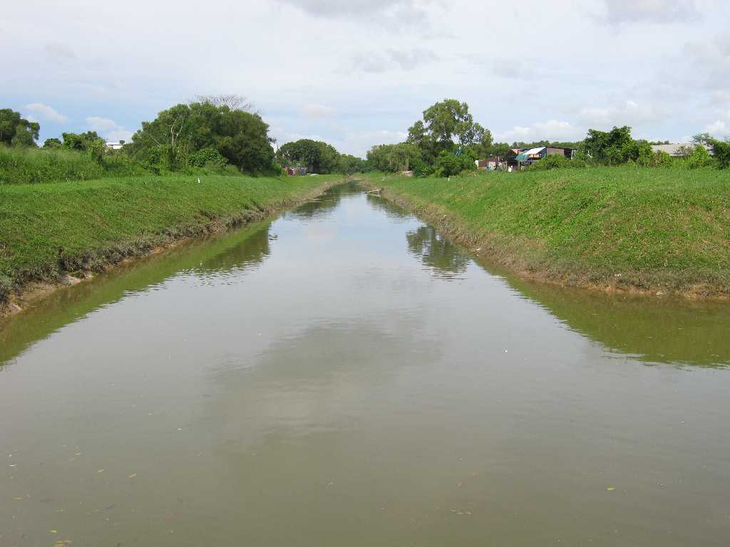
About less than 200m outside the kampong we came across a drain flowing into the reservoir. Upon following the drain upstream we came to Lorong Buangkok. The old kampong trail was left abandoned with trees growing well here.


Abandoned Lorong Buangkok


Mid-way along the park connector was the Sengkang Riverside Park and the Floating Wetland (besides the Sengkang Sports Complex). Fruit trees of various types (such as starfruits, bananas, pineapple plants, lychee, mango, pomelo) were planted in the park. Flowering plants were planted on the wetland and have already attracted various types of butterflies and birds - a sign of a good ecological balance.


Sengkang Floating Wetland


The new park connector was almost complete between Buangkok and Punggol except for a small stretch to be finished in a few months just before the Punggol Marina at the western end of the Punggol Waterway.


Punggol Park Connector Under Construction


Our walk terminated at Nibong LRT station where we took shelter from the thunderstorm

Related articles
Punggol Waterway | Punggol Promenade
Punggol Point
Pasir Ris to Buangkok

April 29, 2011

Punggol Point

This walk was meant to discover to what extent the Punggol Park Connector (PCN) has been completed. We started from Punggol MRT Station, walked past Nibong station and headed for Punggol Marina from where we accessed the PCN.

Punggol Marina
The path from Punggol Marina until Punggol Point (PP) was completed.

Punggol Park Connector

Punggol Point Lookout
From PP eastward there was a stretch until Coney Island dam that was in the final stage of completion before opening to the public.
Punggol Park Connector-Coney Island in the background
Coney Island or Pulau Serangoon is joined to the mainland by a dam that forms the Serangoon Reservoir. It is currently closed to the public by a fence and being developed into a wildlife park. It used to be visited by boaters from Punggol who wanted some seclusion for their picnic and skiing.

Coney Island
Further stretch of park connector being constructed.

Park connector under construction
Related articles
Punggol Waterway | Punggol Promenade
Punggol Park Connector - from Buangkok to Punggol
Pasir Ris to Buangkok

March 24, 2011

Holland Village to Green Fairways

The route taken was to allow us to view houses in the Leedon Park area before heading for Green Fairways.

We walked along Oei Tiong Ham Park, Leedon Park, Bin Tong Park, Coronation Road West. Many houses (also called good class bungalows or GCB's) in Leedon Park and Bin Tong Park were under construction. Bin Tong Park is a loop and we ended up back we started at one point.

The Vietnamese embassy is at Leedon Park at the same location since the '60s when it was under the South Vietnamese government that was backed by the US.

Embassy of Vietnam
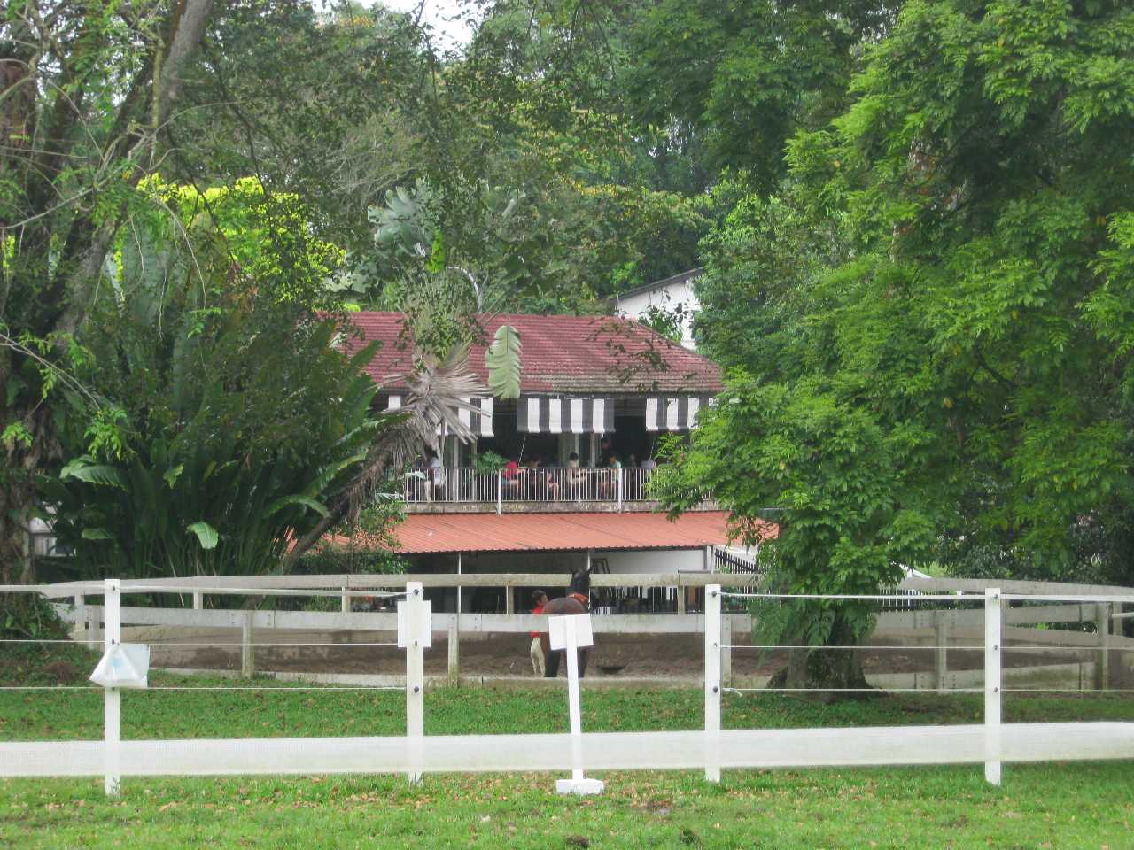
After a p-stop at Coronation Plaza, we crossed over to Dunearn Road to walk towards Eng Neo Road where we followed until we turn into Fairways Drive. The view along this road was like an English countryside with exercise track for horses on one side and stables on the other.


The Riders Cafe here serves great scones.

Riders Cafe

Had a break at the Raintree pub at the driving range. Here one can have a beautiful view of the first hole from the bar counter.

Green Fairways Hole No. 1

On the way out walked past the Riders Cafe to the end of the trail, turned right and followed the trail to the former race track. Another driving range now occupies part of the track. This one is directly accessible by car from Turf City. A rugby club is using another part of the race track.

Turf City Driving Range

Route

View Holland Village to Green Fairways in a larger map

February 15, 2011

Woodcutter Trail

Woodcutter Trail

Gangsa trail - near the entrance to the woodcutter trail
If you are bored with well-defined nature trails with mapboards, signposts and modern amenities, and prefer something more adventurous, then try the Woodcutter Trail. First of all there are no signs/maps/leaflets suggesting such a trail. There is a lack of official information. Information is provided by mountain bikers and trekkers who post their experience on the Internet.

The Woodcutter Trail lies in the Central Catchment Reserve in the central part of Singapore. It connects the Gangsa/Chestnut Bike Tracks on the west to Upper Peirce Reservoir Park on the east. Because of its proximity to the bike trails on the west (alongside the Bukit Timah Expressway), mountain bikers are more familiar with it, although they are not supposed to cycle on the trail.

Granite hill
Entrances to the trail are unmarked so first time visitors may have difficulty finding them. You cannot even find the entrance on the east side as it is purposely obscured. The clue to the entrance lies behind a sign that forbids cyclists using the trail. However the warning is often ignored. Cycling on the trail is discouraged to prevent damage to the trail.

Woodcutter trail
Because the trail is not marked, signs are left in the form of tape hanging on branches to indicate the trail. Of course experienced trekkers can also read the trail itself. When there is heavy rain, certain stretches of the trail will be flooded. So be prepared for wet feet. There are three streams to cross where the trekkers would either cross using branches already laid across them, or stepping across clay pots. Best to bring along walking poles to avoid losing your balance when crossing the streams or walking along the track.

It takes about two and a half hours to cover the trail proper plus another half an hour along Old Thomson Road. Photographers and nature lovers will take longer because of the diversity of plant, animal and insect life.

The Woodcutter Trail runs approximately east-west bounded by Seletar Reservoir to the north and the Upper Peirce Reservoir to the south. The vegetation runs from secondary forest in the east and west to primary forest in the central part. On some days one can hear the sound of firearms from the rifle ranges near the eastern and western parts of Seletar Reservoir.

Crossing a stream
Walking this trail is an entirely different experience especially at certain stretches where the green mantle gets close to you, but not to worry we do not need to cut our way through and knowing that we are not more than 2 hours from the familiar world outside. So enjoy the closest experience to the jungle in urban Singapore.

By the way do detour to the Upper Peirce Reservoir Park which is not too far from the trail entance/exit on Old Upper Thomson Road. There you can see both the scenic Upper Peirce and Lower Peirce Reservoirs separated by the dam. In the old colonial days, such infrastructure projects were named after the engineers. Without the dam, the Upper Peirce Reservoir will be much smaller and less water storage for us.

(P.S. This trail is closed to the public. It is an offence to enter or leave any part of the nature reserve which is closed. Please follow the instructions on the signboards.)

See Also:
Admiralty Park to Sembawang
The Pipeline Trail
Woodlands Town to Bukit Panjang via Ulu Sembawang Park Connector


Woodcutter Trail video